Our Product
The Inland Navigation Simulator (BISS)
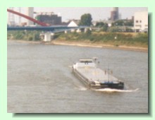
BISS simulates the movement of ships in arbitrary waterways. Thereby it takes other vessels, drift angles, speeds, and trim characteristics (important in shallow water) into account, when it determines the routes which either lead along the given course axes or deviate, when evasive manoevers are necessary.
|
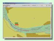
Next to the topographics of the waterways, data concerning the current distribution (along the width and the depth of the waterway) is considered. The results are displayed in electronic sea charts (ENC, electronic navigational chart). In case of BISS, Gauß-Kruger projections are used.
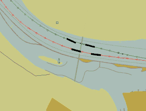
In the animation on the right, the vessels are represented by black rectangles. The green line represents the ideal course for the course downstream, while the red one marks the ideal route for an upstream course. In this case, the progress of four large barges is shown.
|
|
|
|
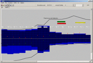
Although the ships spacial movement is represented continuously, the topology and the associated current data is saved in a grid. Thsi simplifies the algorithms and thus leads to much higher simulation speeds.
|
|
|
|


 Company